
Texas City Neighbor Sources by Block
No one official source identifies all people around a Texas City block. The GCAD map supplies adjoining parcel shapes and public district layers. The appraisal card supplies owner, mailing, situs, and property clues. Recorded deeds establish document history, while old directories and telephone books can add dated address evidence. Voter tools are designed for individual confirmation or an authorized public-information request, not a public display of every voter on a block. Use each record only for the question it can answer.
| Source | What it shows about a block | Access route |
|---|---|---|
| GCAD GIS | Adjacent parcel polygons, streets, public districts, lot lines, and city-boundary context | Public interactive map; boundaries are approximate. |
| GCAD parcel card | Owner, mailing and situs addresses, legal clues, values, and property characteristics | Public eSearch; not a complete occupant list. |
| County Clerk AVA | Recorded transfers, plats, and legal descriptions | Online index and clerk counter; online start year was not located. |
| My Voter Portal or file request | Individual registration confirmation or requestable public voter fields | Lookup or written request; protected fields remain withheld. |
| Moore and Rosenberg collections | Historical address, telephone, and community snapshots | Library, reading room, microfilm, or available digital collection. |
Owner and occupant are not interchangeable. A GCAD mailing address can be elsewhere, and a parcel card does not establish everyone who may be present at an address. Keep the public record’s field label, date, and custodian with every block note.
Texas City Neighbors on the GIS Map
The Galveston Central Appraisal District GIS gives the practical starting point for the immediate block. Its published layers include parcels, street centerlines, subdivisions, lot lines, city boundaries, school districts, MUDs, WCIDs, drainage districts, emergency-service districts, and neighborhood maps. Parcels, streets, subdivisions, lot lines, and city boundaries were listed with an April 14, 2026 update date. The viewer is informative, not a legal survey, so use recorded plat or deed material if an edge or right-of-way matters.
- Browse to the Texas City street and locate the target parcel in the GIS viewer.
- Turn on parcel and street-centerline context, click the target polygon, and record the property or geographic ID shown.
- Pan to each adjoining polygon and preserve the same identifiers, situs details, subdivision, lot-block, and available district context.
- Open the related appraisal record, then use a recorded plat or deed to check a boundary break caused by a corner, alley, road, water, or right-of-way.
The official static material does not document a dedicated radius, buffer, export control, or exact live toolbar labels. Limit the process to visible adjoining parcels instead of claiming a GIS radius tool that was not confirmed.
Note: Parcel adjacency describes land around an address, not a complete list of people connected with each parcel.
Texas City Parcel IDs Keep Blocks Straight
Street names alone can cause same-street confusion. GCAD lets a searcher move from Street Number and Street Name to a property result, then use property ID, geographic ID, subdivision, neighborhood, or legal-description clues to keep the target lot separate from an adjoining one. When an address search fails, the official tip is to try a simple street name without prefix, suffix, or unit number. The result still needs a parcel-level confirmation before it is connected to an adjoining address.
From the current parcel card, compare situs and mailing address without treating either as a universal household field. Copy the legal description, such as subdivision and lot/block, before opening the county’s recorded-property route. The County Clerk records search leads to AVA, where grantor and grantee names, recording date, document number, book/page, and legal description form the recorded trail. If online results stop, ask at the County Clerk’s Texas City Records & Elections Center or the Galveston Justice Center whether a public terminal, books, indexes, or certified copies supply older material.
- Parcel
- A mapped tract used for appraisal and geographic identification. It may be different from a street-address label.
- Situs address
- The physical location of the parcel. It is distinct from an owner mailing address.
- Plat
- A recorded map that can establish subdivision, lot, block, and right-of-way context.
- Legal description
- The lot, block, subdivision, abstract, survey, or metes-and-bounds wording used to identify land in a recorded instrument.
Texas City Neighbor Lookup and Voter Records
My Voter Portal is not an open block roster. It uses name, county, date of birth, and ZIP for an individual registration lookup, with Galveston County selected for a Texas City search. It can provide a match clue such as a VUID and voter-registration details that the public lookup displays. It cannot establish every person at an address, and a missing result does not show that a person never lived nearby. Name spelling, former names, county selection, date of birth, status, and list maintenance can all affect a match.
Texas Election Code §18.005 identifies public voter-list elements, while §13.004 protects Social Security, Texas driver-license, and DPS ID information. Protected voters and substitute addresses have further safeguards. A larger county or precinct request uses the Texas voter-registration data public-information form, with its scope and delivery fields, but it does not make protected addresses or identifiers available. The Galveston County voter registrar is located at the County Clerk’s Records & Elections Center in Texas City; written requests should follow the official form and current custodian instructions.
Note: Voter information may confirm an individual record when law permits, but it must never be used to rebuild a protected person’s location.
Texas City Community Anchors, Not Private Rosters
Official Texas City material identifies civic geography and public contacts, not private neighborhood membership lists. The city’s Community Development plans name the Carver, Sanders/Vincent, and Nessler community-center networks as neighborhood anchors. City boards and commissions, community groups, faith organizations, parks, schools, and public-service organizations can provide civic context for a block. The research did not locate an official, current, comprehensive directory of private associations, HOA membership, or block-watch rosters. Do not fill that gap with unverified social profiles or assume a public program creates a resident list.
| Public neighborhood layer | What is available | Appropriate use |
|---|---|---|
| City boards and commissions | Published civic body and application information may vary by board. | Confirm public participation or a city contact, not block membership. |
| Neighborhood Improvement Services | Public department directory and complaint route. | Request existing releasable records; complaint details may be protected. |
| Carver, Sanders/Vincent, Nessler | Community-center networks named in city planning material. | Use as public area anchors, not member directories. |
| Faith and community groups | Organization contacts may be public. | Use only the organization’s published contact, not a presumed household list. |
The Texas City boards and commissions page is the official route for public civic-body information.
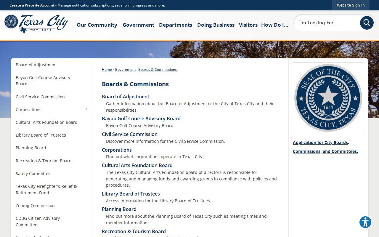
Public civic contacts can explain the services and districts around a block without claiming that a board page reveals household details.
Texas City Neighbors in the 1867 District
The 1867 Settlement Historic District is a useful local boundary quirk. The city describes its edges as Anderson Street to the north, Texas Avenue to the south, State Highway 3 to the east, and Westward Street to the west. Those four streets define a named historic area, not a list of households. If a parcel sits near the boundary, compare its lot and city-map position with the official description rather than treating a historic-district label as proof about its occupants.
The official 1867 Settlement Historic District page provides the district’s stated boundary streets.
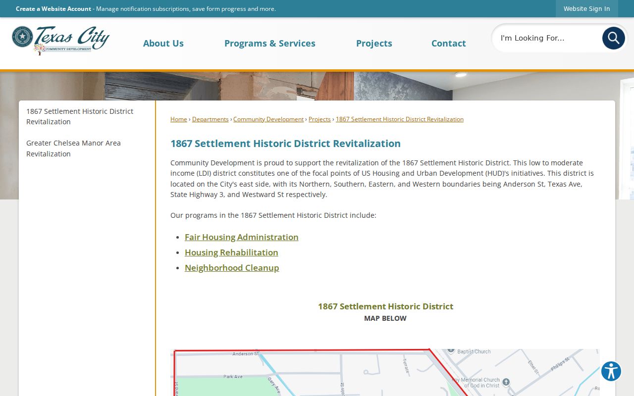
The historic-district map gives context for a Texas City block, while the parcel card and recorded plat identify the individual lot.
Texas City also divides civic geography into Commission Districts 1 through 4. The city district map is a public way to check that layer.
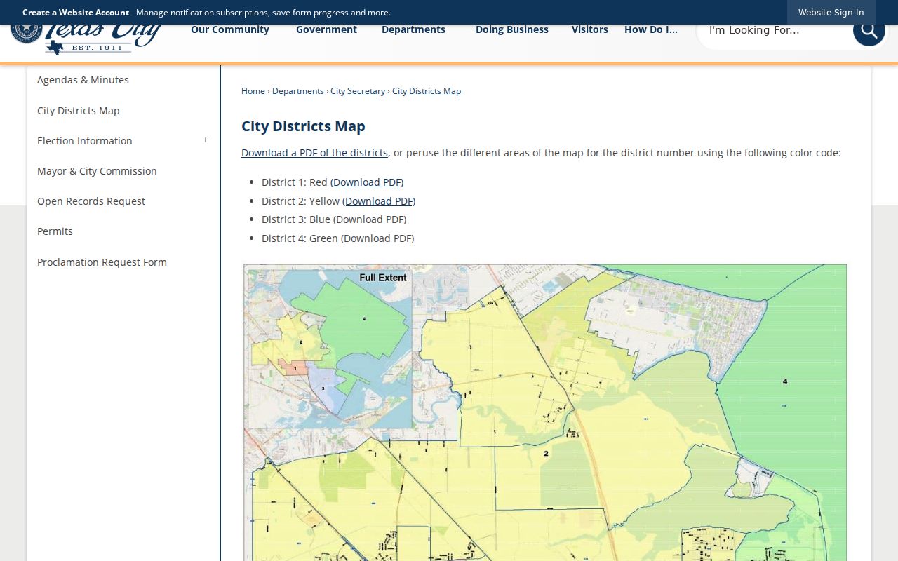
A commission district supplies public civic context, not an address-level roster or proof of who lives on a block.
Texas City Neighbor Tools Compared
Official records and commercial neighbor tools answer different questions. A commercial tool may combine address, property, and marketing associations, but it can carry stale addresses, same-name merges, and gaps for protected people. Official sources are narrower and may need more than one access channel, yet they make it possible to preserve the custodian, field, and date. Use a recorded deed for a title question, the parcel map for adjacency, and a public civic map for district context.
| Approach | Useful for | Important limit |
|---|---|---|
| Official GIS and parcel record | Adjoining parcels, legal and appraisal clues | Shows land and owner-related fields, not every occupant. |
| County Clerk document | Recorded transfers, plats, and legal descriptions | Online coverage start and image terms require verification; counters are a fallback. |
| Commercial neighbor category | General address associations | May be stale, merge similar names, or omit protected residents. |
A whole named-street record chain needs a different scope. Use the Texas City streets reference when the question extends beyond the immediate adjoining parcels.
Privacy Boundaries for Texas City Neighbors
Public property and civic records leave out much of private life. A parcel card does not list all occupants. Utility, motor-vehicle, sealed court, protected vital, and protected voter information are not a block-search source. Texas’s Address Confidentiality Program protects eligible survivors and protected officials, and voter suppression rules can keep an actual residence from appearing as a public voter address. No collection of adjacent parcels should be used to reconstruct a protected location.
When a public source is wrong, contact the office that maintains that particular record with its identifier and supporting documentation. GCAD controls appraisal data, the County Clerk controls recorded documents, and election officials control voter material. Moore Memorial’s older directories and Texas City Sun microfilm may give dated historical context, but neither should be converted into a current-neighbor claim.
Note: When the record cannot answer a block question, preserve the limitation and ask the responsible custodian about lawful access instead of guessing.